

 English
 Karte in atlasi


- leto izdaje 2022: Avstrija, Češka, Grčija, Italija, Madžarska, Poljska, Portugalska, Španija
- leto izdaje 2023: Hrvaška & BiH

- Aeronautical chart on a scale of 1:200.000
- Based on ICAO Annex 4; EU-Commission Regulations; AIP
- Very clear representation of the ATS airspace structure
- Reporting points, border crossing points
- Prohibited, danger- and restricted areas
- Aerial sporting and recreational activities
- Areas with sensitive fauna
- Laminated
Product Description
Special features for this region:
- Approach procedures, traffic pattern, reporting points, holdings
- Recommended VFR Routes
- TRAs temporary reserved airspaces
- Aerial sporting and recreational activities
- Areas with sensitive fauna
- Ultralight landing site
- TAs military training areas (commonly known as MTA in the surrounding countries)
- Significant points (border crossing points)
All Rogers Data VFR charts are designed to the following criteria:
- Aeronautical chart on a scale of 1:200.000
- Based on ICAO Annex 4; EU-Commission Regulations; AIP
- Very clear representation of the ATS airspace structure
- Very detailed highly sophisticated terrain map with shading and relief
- Airports, aerodromes and heliports with additional information
- Radio Navigation Aids with name, frequency and morse code
- TMZ transponder mandatory zones
- Compulsory reporting points, reporting points on request, significant points (border crossing)
- Prohibited, danger- and restricted areas
- Obstacles or group of obstacles
- Minimum Grid Area Altitude
- Isogonic line model with magnetic variation
- With the ROGERS DATA navigation compass 200, track, time and distance in the scale of 1:200.000 can be easily measured

- Aeronautical chart on a scale of 1:500.000
- According to ICAO Annex 4; EU-Commission Regulations; AIP
- Clear representation of the ATS airspace structure
- Reporting points, border crossing points
- Prohibited, danger- and restricted areas
- Aerial sporting and recreational activities
- Areas with sensitive fauna
Product Description
Special features for this region:
- Recommended VFR Routes
- Water aerodromes
- Aerial sporting and recreational activities
- Areas with sensitive fauna
- Low level military flight corridors and training areas
- ATZ aerodrome traffic zone
- Significant points (border crossing points)
All Rogers Data VFR charts are designed to the following criteria:
- Aeronautical chart on a scale of 1:500.000
- According to ICAO Annex 4; EU-Commission Regulations; AIP
- Clear representation of the ATS airspace structure
- Detailed highly sophisticated terrain map with shading and relief
- Airports, aerodromes and heliports with additional information
- Radio Navigation Aids with name, frequency and morse code
- TMZ transponder mandatory zones
- Compulsory reporting points, reporting points on request
- Danger- and restricted areas
- Obstacles or group of obstacles
- Minimum Grid Area Altitude
- Isogonic line model with magnetic variation
- With the ROGERS DATA navigation compass 500, track, time and distance in the scale of 1:500.000 can be easily measured

- Aeronautical chart on a scale of 1:500.000
- According to ICAO Annex 4; EU-Commission Regulations; AIP
- Clear representation of the ATS airspace structure
- Reporting points, border crossing points
- Danger-and restricted areas
- Aerial sporting and recreational activities
- Areas with sensitive fauna
Product Description
Special features for this region:
- VFR sectors at international airports
- TRAs temporary reserved air spaces
- Aerial sporting and recreational activities
- Areas with sensitive fauna
- Military exercise and training areas
- Significant points (border crossing points)
All Rogers Data VFR charts are designed to the following criteria:
- Aeronautical chart on a scale of 1:500.000
- According to ICAO Annex 4; EU-Commission Regulations; AIP
- Clear representation of the ATS airspace structure
- Detailed highly sophisticated terrain map with shading and relief
- Airports, aerodromes and heliports with additional information
- Radio Navigation Aids with name, frequency and morse code
- TMZ transponder mandatory zones
- Compulsory reporting points, reporting points on request
- Danger- and restricted areas
- Obstacles or group of obstacles
- Minimum Grid Area Altitude
- Isogonic line model with magnetic variation
- With the ROGERS DATA navigation compass 500, track, time and distance in the scale of 1:500.000 can be easily measured

- Aeronautical chart on a scale of 1:500.000
- According to ICAO Annex 4; EU-Commission Regulations; AIP
- Clear representation of the ATS airspace structure
- Reporting points, border crossing points
- Prohibited, danger- and restricted areas
- Aerial sporting and recreational activities
- Areas with sensitive fauna
Product Description
Special features for this region:
- TRAs temporary reserved air spaces
- Aerial sporting and recreational activities
- Areas with sensitive fauna
- Heliports with name of Operator
- Significant points (border crossing points)
All Rogers Data VFR charts are designed to the following criteria:
- Aeronautical chart on a scale of 1:500.000
- According to ICAO Annex 4; EU-Commission Regulations; AIP
- Clear representation of the ATS airspace structure
- Detailed highly sophisticated terrain map with shading and relief
- Airports, aerodromes and heliports with additional information
- Radio Navigation Aids with name, frequency and morse code
- TMZ transponder mandatory zones
- Compulsory reporting points, reporting points on request
- Danger- and restricted areas
- Obstacles or group of obstacles
- Minimum Grid Area Altitude
- Isogonic line model with magnetic variation
- With the ROGERS DATA navigation compass 500, track, time and distance in the scale of 1:500.000 can be easily measured

VFR aeronautical chart Italy Center - Italia Centro 500k or
VFR aeronautical chart Italy South & Lampedusa & Malta - Italia Sud & Lampedusa & Malta 500k or
VFR aeronautical chart Italy West Sardegna & Corse - Italia Ovest & Sardegna & Corse 500k
- Aeronautical chart on a scale of 1:500.000
- According to ICAO Annex 4; EU-Commission Regulations; AIP
- Clear representation of the ATS airspace structure
- Reporting points, border crossing points
- Prohibited, danger- and restricted areas
- Aerial sporting and recreational activities
- Areas with sensitive fauna
- laminated
Product Description
Special features for this region:
- Aeroporto, Aviosuperfici and Campo volo
- CTRs and CTRs from a specified lower limit
- Compulsory reporting points, reporting points on request, with ICAO letter code
- Significant points (border crossing)
- Ultra light machine activity ULM/VDS
- Aerial sporting and recreational activities
- Areas with sensitive fauna
- Military exercise and training areas
- Significant points (border crossing points)
All Rogers Data VFR charts are designed to the following criteria:
- Aeronautical chart on a scale of 1:500.000
- According to ICAO Annex 4; EU-Commission Regulations; AIP
- Clear representation of the ATS airspace structure
- Detailed highly sophisticated terrain map with shading and relief
- Airports, aerodromes and heliports with additional information
- Radio Navigation Aids with name, frequency and morse code
- TMZ transponder mandatory zones
- Compulsory reporting points, reporting points on request
- Danger- and restricted areas
- Obstacles or group of obstacles
- Minimum Grid Area Altitude
- Isogonic line model with magnetic variation
- With the ROGERS DATA navigation compass 500, track, time and distance in the scale of 1:500.000 can be easily measured

- Panorama map on a scale of 1:2.500.000
- Aerodromes with ICAO code
- Colourful and accurate
- Urban areas
- International borders
- VFR an IFR aerodromes
- Civil- and military aerodromes
calculating flight times, ranges and radius of action. It shows European aerodromes and contains important topographical information.
Colorful and accurate, these maps clearly depict international boundaries, major cities and towns, rivers, lakes, mountain ranges. Also listed are major airports and aerodromes. This map is great for pilots and aviation enthusiasts alike. This extremely detailed map includes hundreds of airports both civil and military, IFR and VFR. Ideal to get an overview for preliminary flight planning and makes a great wall poster! Urban areas, terrain contours, topographical features including bodies of water and more.
European Aerodromes Rogers Data 2.500k uses a scale of 1:2.500.000.
Whether you're a captain of a jumbo jet, a passenger on their first flight, or anything in between, this map and shown information has something for you! There are 2 map sheets (north and south), in the middle you can stick those ones together. Perfect for School- and Flight preparation-rooms or for your home.
Dimensions: W137,5cm x H94cm

Airspace structure: 2024
Scale: 1:200,000
Format: A5
- VFR Trip Kit in DIN A5 format with spiral binding
- Compilation of all civil and military airfields in Slovenia
- Approach procedures, traffic patterns and reporting points of all airfields included
- Approach sheets in a scale of 1:200,000
- Airfield maps with aerial photos and graphic additions
- High-quality paper, digitally printed
- Spiral binding in Metal, leaves can be completely folded
- Good handling in the cockpit
- VFR Trip Kit in DIN A5 format with spiral binding
- For the first time, all civil and military airfields in Slovenia are included in a VFR Trip Kit
- Airfield maps with aerial photos and graphic additions
- Approach sheets on a scale of 1:200,000
- Very detailed representation of the airspace
- VFR sectors Airports, VFR sectors at airfields
- Arrival and departure procedures, traffic patterns, reporting points, waiting procedures
- Detailed special topographic background map with hillshading and relief
- The VFR Trip Kit was produced on very high-quality, stable paper of excellent quality
- Sheets can be completely turned over, good handling in the cockpit
- Index of airfields with the respective frequency
- Interception signals, conversion table, Morse code, ATC Light Gun Signals
- Altitude Correction, Military Aircraft National Insignia, ALPFOR key Slovenia
- BCMT and ECET table
Airspace structure: 2024
Scale: 1:200,000
Format: A5
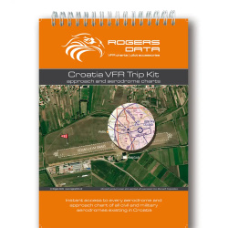
- VFR Trip Kit in DIN A5 format with spiral binding
- Compilation of all civil and military airfields (including water aerodromes) Croatia
- Approach procedures, traffic patterns and reporting points of all airfields included
- Approach sheets in a scale of 1:200,000
- Airfield maps with aerial photos and graphical additions
- High-quality paper, digital printed
- Spiral binding in metal, sheets can be completely turned over
- Easy to handle in the cockpit
- VFR Trip Kit in DIN A5 format with spiral binding
- For the first time, all of Croatia's civil and military airfields are included in a VFR Trip Kit
- Airfield maps with aerial photos and graphic additions
- Approach sheets on a scale of 1:200,000
- Very detailed representation of the airspace
- VFR sectors Airports, VFR sectors at airfields
- Arrival and departure procedures, traffic patterns, reporting points, waiting procedures
- Detailed special topographic background map with hillshading and relief
- The VFR Trip Kit was produced on very high-quality, stable paper of excellent quality
- Sheets can be completely turned over, good handling in the cockpit
- Index of airfields with the respective frequency
- Interception signals, conversion table, Morse code, ATC Light Gun Signals
- Altitude Correction, Military Aircraft National Insignia
- BCMT and ECET table
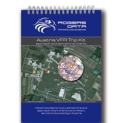
Airspace structure: 2024
Scale: 1:200,000
Format: A5
- VFR Trip Kit in DIN A5 format with spiral binding
- Compilation of all civil and military airfields in Austria
- Approach procedures, traffic patterns and reporting points of all airfields included
- Approach sheets in a scale of 1:200,000
- Airfield maps with aerial photos and graphic additions
- High-quality paper, digitally printed
- Spiral binding in Metal, leaves can be completely folded
- Good handling in the cockpit
- VFR Trip Kit in DIN A5 format with spiral binding
- For the first time, all of Austria's civil and military airfields are included in a VFR Trip Kit
- Airfield maps with aerial photos and graphic additions
- Approach sheets on a scale of 1:200,000
- Very detailed representation of the airspace
- VFR sectors Airports, VFR sectors at airfields
- Arrival and departure procedures, traffic patterns, reporting points, waiting procedures
- Detailed special topographic background map with hillshading and relief
- The VFR Trip Kit was produced on very high-quality, stable paper of excellent quality
- Sheets can be completely turned over, good handling in the cockpit
- Index of airfields with the respective frequency
- Interception signals, conversion table, Morse code, ATC Light Gun Signals
- Altitude Correction, Military Aircraft National Insignia, ALPFOR key Austria
- BCMT and ECET table

The Pilots Atlas Eastern Hemisphere (Europe,Middle East and S.E. and Asia)
JNC scale, topographical charts are used showing over 4,500 airportsWaypoints, VOR/DME, NDB´s and special use airspace are included, plusweather frequencies, points of interest, landmarks, airport-directorywith ICAO-codes, railways, rivers, major highways, just to name a few.Airports are colour coded by runway length and surface. International/regional Aerodromes are coded by symbol shape. Pilots now have theability to point out objects on the ground or know immediately wherethey are in relation to surrounding airports or points of interest: anall-in-one source of information for pre-flight or during flight.
- Completely new cartography
- Completely new aeronautical data
- new airport directory
- new overview maps
- new Captain's Corner
- Expanded Area
- 16 additional pages cartography
- now 224 pages content◦158 pages maps
- 39 pages Captain's Corner
- 27 pages overviews
- complete Atlas is printed in color
- with ICAO-codes, waypoints, VOR's, NDB's, etc.
- restricted, prohibited and danger areas
- High quality, foiled cover
Size: 20 cm x 28 cm, 224 pages, 4-color
- Paper Quality: Cover: 250 g/qm, wood-free, Glossy-Paper
- Contents: 65 g/qm, wood-free, Matt
- Cover: Clear foil laminate, Simi-Gloss
- Overview-maps: 27 pages
- Europe-coverage: 96 pages, scale: 1: 2,000,000
- South-Africa-coverage: 8 pages, scale: 1: 2,750,000
- Mid-East & Asia: 54 pages, scale: 1: 4,000,000
- Captains Corner: 39 pages
Description:
Base Cartography is a street atlas. Basic information such as:mountains, lakes, rivers, railway lines, national boundaries, cities,villages, highways, country roads, natural parks and sights arenaturally included in the maps. In addition, aeronautical informationhas been incorporated: more than 4,500 ICAO codes with color coding forthe runway length, VOR / DME's with frequencies, NDBs, waypoints withcode and VOLMET frequencies.
- 4 pages Europe & Asia Political, 2 pages Climate Winds,
- 2 pages star chart north pole, 2 page time zones webabbreviation.,
- 2 pages North Atlantic overview, 2 pages Africa overview,
- 4 pages Asia Middle East overview and 2 pages
- Pacific Overview, 2 Pages Australia Overview.
- 1 double page North Atlantic routes
- 1 double page African continent
- 2 doublepages Asia routes to Japan
- 1 double pages Pacific routs
- 1 double pages Australia routs
- 1 double page North Pole and star chart and 4 pagesSatellite picture Europe & Asia with mainwinds avrage,
- 2 pages Europe & Asia political map
- 1 page star chart
- 1 page polar chart
- 2 pages timezones with web-suffixes
Captains Corner:
39 pages of aeronautical information updated with thelatest JAA information. To the Airport Directory in the CaptainsCorner, we have added the coordinates (Lat / Long) for every airport.World Aircraft Registration, Volmet-Broadcasts, Weather Symbols, Metar,Climb Gradients, Conversion Tables, Crosswind Component, Holding,Aerodrome Operating Minima, De-icing Table, Aerodrome Signs Signalsand Abbreviations and…..

Tri ali štiri barvni komplet pisal za označevanje in načrtovanje na papirnatih ali laminiranih letalskih kartah. Po uporabi je črnilo mogoče odstraniti z radirko, vendar je črnilo dovolj obstojno, da se ne odstrani med normalno uporabo karte.
Komplet vsebuje: 3 ali 4 pisala.
- Črn, moder in rdeč.
- Črn, moder, rdeč in zelen

Set 4 permanentnih flomastrov Staedtler Lumocolor® 318/4 s "Fine" pisalno konico. Permanentni flomastri so na alkoholni osnovi, primerni za pisanje po skoraj vseh površinah. V paketu so: črn, rdeč, zelen in moder.
Flomastri so primerni za pisanje na laminirane karte. Prednost teh flomastrov je, da so zapisi takoj posušijo in jih s prstom ni mogoče "zabrisati". Po končani uporabi jih preprosto odstranimo z alkoholom brez poškodb karte.
Konica: F (0,6 mm)

The Chart Organizer is made of a high quality, durable nylon.
With its sophisticated layout and innovative folding and closure system, it provides the most efficient storage for aeronautical charts.
For that to be available:
- 6 pockets for VFR ot IFR charts
- 3 pockets for credit, fuel, or insurance cards
- 1 business card holder
- 1 pen holder
- 1 transparent pocket for licences, medicals, etc.
- 1 pocket for CDs or similar
Dimension (H x W x D):
28 x 17 x 3cm
Color: black

Holds all the necessary flight paperwork right where pilots need it, leaving their hands free to fly. Simple to install, the black plastic, i-beam construction is strong enough to serve as a pilot's third hand.
The clip is higher than other yoke clips, holding sectionals, approach plates, flight logs, checklists, flight computers, and pens in easy view. The unique, over-centering cam easily adjusts to fit all general aviation aircraft yokes without modification.

- 1