

 Slovensko
 Latest Products
-
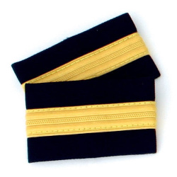
 One bar Pilot Epaulettes (I)
12,00€ Inc Tax
One bar Pilot Epaulettes (I)
12,00€ Inc Tax -
 One bar Pilot Epaulettes (I)
12,00€ Inc Tax
One bar Pilot Epaulettes (I)
12,00€ Inc Tax -
 Modern Jet Fighter kit
18,00€ Inc Tax
Modern Jet Fighter kit
18,00€ Inc Tax -
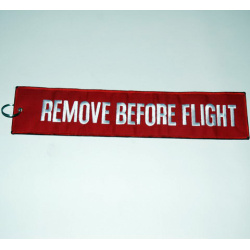 Remove Before Flight Keychain - 17x4.5cm
8,00€ Inc Tax
Remove Before Flight Keychain - 17x4.5cm
8,00€ Inc Tax -
Remove Before Flight Keychain - 36x8cm
17,90€ Inc Tax
-
 Magnet Boeing 737
14,00€ Inc Tax
Magnet Boeing 737
14,00€ Inc Tax -
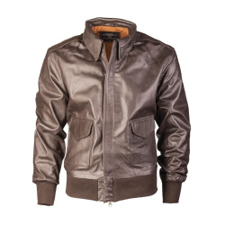 Leather Pilot Jacket A2, brown
245,00€ Inc Tax
Leather Pilot Jacket A2, brown
245,00€ Inc Tax -
 US MA1® Flight Jacket, black (summer )
49,00€ Inc Tax
US MA1® Flight Jacket, black (summer )
49,00€ Inc Tax


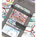
European Aerodromes South – Panorama Chart
28,70€ Inc Tax
European Aerodromes South Rogers Data chart – Panorama Chart, Edition 2017-2020
calculating flight times, ranges and radius of action. It shows European aerodromes and contains important topographical information.
Colorful and accurate, these maps clearly depict international boundaries, major cities and towns, rivers, lakes, mountain ranges. Also listed are major airports and aerodromes. This map is great for pilots and aviation enthusiasts alike. This extremely detailed map includes hundreds of airports both civil and military, IFR and VFR. Ideal to get an overview for preliminary flight planning and makes a great wall poster! Urban areas, terrain contours, topographical features including bodies of water and more.
European Aerodromes Rogers Data 2.500k uses a scale of 1:2.500.000.
Whether you're a captain of a jumbo jet, a passenger on their first flight, or anything in between, this map and shown information has something for you! There are 2 map sheets (north and south), in the middle you can stick those ones together. Perfect for School- and Flight preparation-rooms or for your home.
Dimensions: W137,5cm x H94cm
- Panorama map on a scale of 1:2.500.000
- Aerodromes with ICAO code
- Colourful and accurate
- Urban areas
- International borders
- VFR an IFR aerodromes
- Civil- and military aerodromes
calculating flight times, ranges and radius of action. It shows European aerodromes and contains important topographical information.
Colorful and accurate, these maps clearly depict international boundaries, major cities and towns, rivers, lakes, mountain ranges. Also listed are major airports and aerodromes. This map is great for pilots and aviation enthusiasts alike. This extremely detailed map includes hundreds of airports both civil and military, IFR and VFR. Ideal to get an overview for preliminary flight planning and makes a great wall poster! Urban areas, terrain contours, topographical features including bodies of water and more.
European Aerodromes Rogers Data 2.500k uses a scale of 1:2.500.000.
Whether you're a captain of a jumbo jet, a passenger on their first flight, or anything in between, this map and shown information has something for you! There are 2 map sheets (north and south), in the middle you can stick those ones together. Perfect for School- and Flight preparation-rooms or for your home.
Dimensions: W137,5cm x H94cm
- Availability: In Stock
- Model: EU-AERODROMES-S
-
Manufacturer:


-
 VFR aeronautical chart Germany
34,90€ Inc Tax
VFR aeronautical chart Germany
34,90€ Inc Tax -
 VFR aeronautical chart Italy
29,90€ Inc Tax
VFR aeronautical chart Italy
29,90€ Inc Tax -
 VFR aeronautical chart Hungary
29,90€ Inc Tax
VFR aeronautical chart Hungary
29,90€ Inc Tax -
 VFR aeronautical chart Croatia & Bosnia and Herzegovina
29,90€ Inc Tax
VFR aeronautical chart Croatia & Bosnia and Herzegovina
29,90€ Inc Tax -
 VFR aeronautical chart Austria
24,90€ Inc Tax
VFR aeronautical chart Austria
24,90€ Inc Tax -
 VFR aeronautical chart Slovenia
29,90€ Inc Tax
VFR aeronautical chart Slovenia
29,90€ Inc Tax -
 Chart Organizer
25,00€ Inc Tax
Chart Organizer
25,00€ Inc Tax -
 Removable Pens for Charts
16,10€ Inc Tax
Removable Pens for Charts
16,10€ Inc Tax -
 ASA Yoke Clip
21,00€ Inc Tax
ASA Yoke Clip
21,00€ Inc Tax -
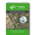 Slovenia VFR Trip Kit
44,90€ Inc Tax
Slovenia VFR Trip Kit
44,90€ Inc Tax


