

 Slovensko
 Latest Products
-
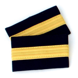
 One bar Pilot Epaulettes (I)
12,00€ Inc Tax
One bar Pilot Epaulettes (I)
12,00€ Inc Tax -
 One bar Pilot Epaulettes (I)
12,00€ Inc Tax
One bar Pilot Epaulettes (I)
12,00€ Inc Tax -
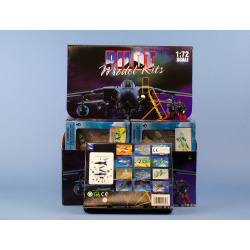 Modern Jet Fighter kit
18,00€ Inc Tax
Modern Jet Fighter kit
18,00€ Inc Tax -
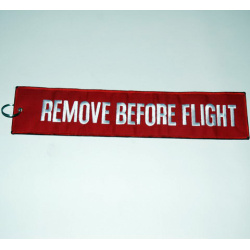 Remove Before Flight Keychain - 17x4.5cm
8,00€ Inc Tax
Remove Before Flight Keychain - 17x4.5cm
8,00€ Inc Tax -
Remove Before Flight Keychain - 36x8cm
17,90€ Inc Tax
-
 Magnet Boeing 737
14,00€ Inc Tax
Magnet Boeing 737
14,00€ Inc Tax -
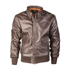 Leather Pilot Jacket A2, brown
245,00€ Inc Tax
Leather Pilot Jacket A2, brown
245,00€ Inc Tax -
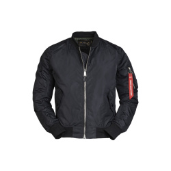 US MA1® Flight Jacket, black (summer )
49,00€ Inc Tax
US MA1® Flight Jacket, black (summer )
49,00€ Inc Tax


The Pilots' Free Flight Atlas
The Pilots Atlas Eastern Hemisphere (Europe,Middle East and S.E. and Asia)
JNC scale, topographical charts are used showing over 4,500 airportsWaypoints, VOR/DME, NDB´s and special use airspace are included, plusweather frequencies, points of interest, landmarks, airport-directorywith ICAO-codes, railways, rivers, major highways, just to name a few.Airports are colour coded by runway length and surface. International/regional Aerodromes are coded by symbol shape. Pilots now have theability to point out objects on the ground or know immediately wherethey are in relation to surrounding airports or points of interest: anall-in-one source of information for pre-flight or during flight.
- Completely new cartography
- Completely new aeronautical data
- new airport directory
- new overview maps
- new Captain's Corner
- Expanded Area
- 16 additional pages cartography
- now 224 pages content◦158 pages maps
- 39 pages Captain's Corner
- 27 pages overviews
- complete Atlas is printed in color
- with ICAO-codes, waypoints, VOR's, NDB's, etc.
- restricted, prohibited and danger areas
- High quality, foiled cover
Size: 20 cm x 28 cm, 224 pages, 4-color
- Paper Quality: Cover: 250 g/qm, wood-free, Glossy-Paper
- Contents: 65 g/qm, wood-free, Matt
- Cover: Clear foil laminate, Simi-Gloss
- Overview-maps: 27 pages
- Europe-coverage: 96 pages, scale: 1: 2,000,000
- South-Africa-coverage: 8 pages, scale: 1: 2,750,000
- Mid-East & Asia: 54 pages, scale: 1: 4,000,000
- Captains Corner: 39 pages
Description:
Base Cartography is a street atlas. Basic information such as:mountains, lakes, rivers, railway lines, national boundaries, cities,villages, highways, country roads, natural parks and sights arenaturally included in the maps. In addition, aeronautical informationhas been incorporated: more than 4,500 ICAO codes with color coding forthe runway length, VOR / DME's with frequencies, NDBs, waypoints withcode and VOLMET frequencies.
- 4 pages Europe & Asia Political, 2 pages Climate Winds,
- 2 pages star chart north pole, 2 page time zones webabbreviation.,
- 2 pages North Atlantic overview, 2 pages Africa overview,
- 4 pages Asia Middle East overview and 2 pages
- Pacific Overview, 2 Pages Australia Overview.
- 1 double page North Atlantic routes
- 1 double page African continent
- 2 doublepages Asia routes to Japan
- 1 double pages Pacific routs
- 1 double pages Australia routs
- 1 double page North Pole and star chart and 4 pagesSatellite picture Europe & Asia with mainwinds avrage,
- 2 pages Europe & Asia political map
- 1 page star chart
- 1 page polar chart
- 2 pages timezones with web-suffixes
Captains Corner:
39 pages of aeronautical information updated with thelatest JAA information. To the Airport Directory in the CaptainsCorner, we have added the coordinates (Lat / Long) for every airport.World Aircraft Registration, Volmet-Broadcasts, Weather Symbols, Metar,Climb Gradients, Conversion Tables, Crosswind Component, Holding,Aerodrome Operating Minima, De-icing Table, Aerodrome Signs Signalsand Abbreviations and…..
- Availability: In Stock
- Model: AZ-ATL-EU
-
Manufacturer:


-
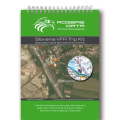 Slovenia VFR Trip Kit
44,90€ Inc Tax
Slovenia VFR Trip Kit
44,90€ Inc Tax -
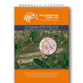 Croatia VFR Trip Kit
49,90€ Inc Tax
Croatia VFR Trip Kit
49,90€ Inc Tax -
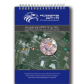 Austria VFR Trip Kit
54,90€ Inc Tax
Austria VFR Trip Kit
54,90€ Inc Tax


